Unexpected for a city next to the sea and pedestrian like Venice undoubtedly is, air pollution surpassed the legal limits for many days on January and Febbruary 2017 (ilGazzettino.it). Such limit is the Pm10 level (particulate matter), which creates allarmism in the population.
People complained for the local governement management and the partial traffic-block in urban areas and also in the center of Mestre.
An efficient territorial management should go at the same pace with the political promotion of the sustainable transport, in order to avoid traffic restrictions and insurgence of respiratory patologies. It means that the use of bycicle is even more promoted by several fronts, united each other for their dedication for improve public health, movement capacities of people in the urban pattern and for a bettersense of life for citizens.
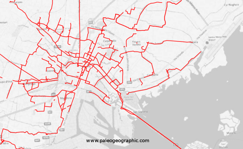
Today, the cycle network of the City of Venice (see “data sources”) is not frequently updated, due to the frenetic urban development and enlargement of peripheries, and also for requalification in Gazzera District and S.Angelo hospital.
For daily movements, citizens don’t use only reserved cycle lanes, instead they exploit roadway edge and promiscuous sidewalk with pedestrians.
For this reason, in the following map we show cycle lanes released by the Municipality (completely built and not), and alternative safe itineraries for the viability (excluding only the roadway edge used also by cars).
Require the .kml file to egpaleo@gmail.com
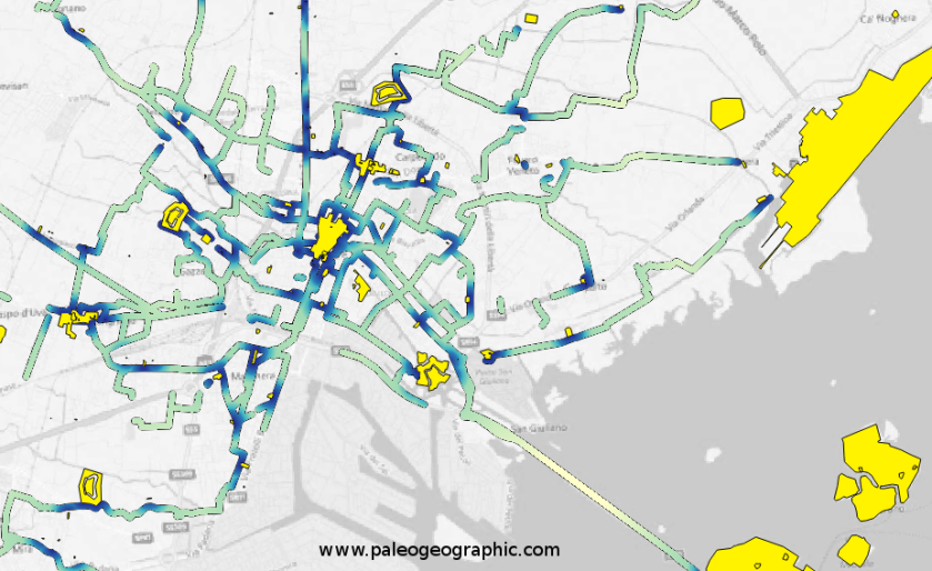
Cycling experience is more enjoyable When It is possible to admire the skyline and historical buildings. So, we selected a series of interesting places (military forts of the ancient Serenissima Republic of Venice, Venetian Villas, and historical center of Mestre, but not only) with a proximity analysis, underlining which of them are closely related to our itinerary.
We obtained this map, where blue intensity is positively related to the interesting locations.
PS: La carta da noi pubblicata non è sicuramente del tutto esaustiva, ma mostra una rete viaria più capillare rispetto a quelle ufficiali, e vuole servire da spunto per lasciare l’auto a casa e cominciare a pedalare, ammirando le opere paesaggisticamente di rilievo del territorio comunale.
In 2017, a new project for the City of Padua have been created, in collaboration with the University of Padua and an entusiastic team of students and private collaborators.
See more here at PISTE riCICLABILI
Software utilizzati:
 QGIS
 Google Earth Pro
 OpenStreetMap

Data Sources:
 Rete ciclabile del Comune di venezia
 OpenStreetMap
 Portale Cartografico Regionale
![]()
